| Proximo | Umuarama - Campos do Jordão - Sao Paulo - Florestas Nativas Preservadas |  |
|
In Umuarama are the most beautiful
hiking trails in C. Jordão - 13 Kms
In order to guide the walkers, about the extent and characteristics of
the tracks (flat or hilly), a survey of distances was proceeded, in order
to allow walkers, to plan their tour in advance. The hills are provided
with benches for enjoying the view; It's
advisable to choose e flat terrain on the
first walk, for not forcing the
heart (due to the altitudes).Table of distances |
| 1) |
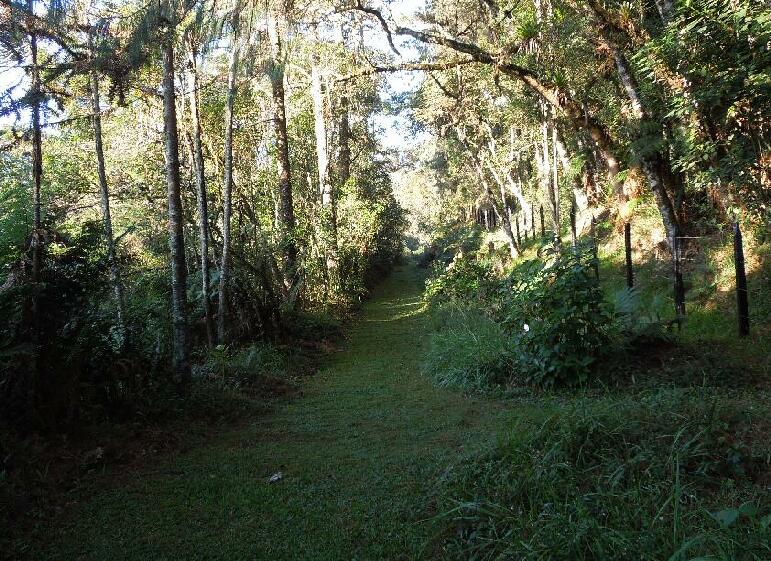
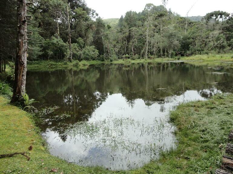
Trail around the lakes - Walking
distance :1,400 mts
Departing from "Colonia" Mackenzie, skirts up the 1st lake East side towards the upper lake, past the "Methodist Island", heading towards South, walking all around until you get back to the upper Lake dam, and to the starting point ("Colonia"); |
| 2) |
Umuarama
Creek Trail (Predominantly level ) - (1,070
mts)
Starts at the
“U” Walk the steps down, to reach the creek, it takes you
through the native forest along the stream
until you see the singn "Colonia";
|
| 3) |
Track
"Zig-zag " - (1400
mts)
At the top of the hill you
will find benches
to rest and admire the view over Umuarama, its forests and fields
and the surroundings; ( Steps provided where needed);
|
| 4) |
Orchard
Trail - (hilly
with steps - 1,100 mts)
Walk
along the old Umuarama orchard right in front the "Colonia".
This leads you Eastward penetrating into the Native Forest,
coming to a small
gate located along the northern boundary of the Mackenzie area.
There are three options for your way back: I) Return by the same trail (1,100 mts); II) Go to the East, along the border (1.050 Mts), returning to "Colônia" by V. Caajara, "Acampamento Mackenzie" and "Oripaba" properties ; III) Follow Westward along the border area with "Cond. Céu Azul", along the cypress hedge (planted in 1999), until you reach the "Zig-zag" benches (660 mts); This might be the best option to return to the "Colonia" - (750 mts); |
| 5) |
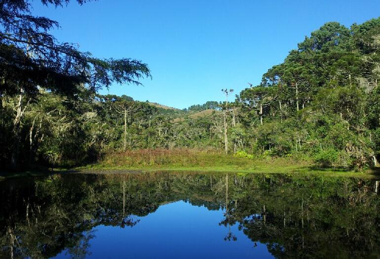
"7 - Falls" Track (to
the water sources);
These watersheds provide
Umuarama with pure water.
From the "Colonia",
passing around the upper lake and its dam, following the
trail you'll find the entrance to the "7-Falls Trail". Enjoy an
exceptional view along the stream with small waterfalls. This very
water flows to the La Plata River in Argentina.
After walking
1,400 mts.you'll find a
fork where you'll choose
between 2options for walking back: 1) Follow the "Ferns'-Trail" 1,350 mts to return to the starting point ; 2) Go to the right reaching the field, where you'll find a bench for enjoying the view towards North and West. Once reaching the valley, there shall be 2 options: 1) Walk up the hill reaching the general Umuarama water Reservoir, 2) down towards the valley, landing at the Upper Lake Dam and "Colonia"; |
| 6) |
Track
towards "Itassú" and "Itamuarama" Peaks;
From
the upper Dam,
walk to a curve of the eastbound road.
At the left next to abench starts the Path provided with steps (it's
quite hilly), to reach the 1st
bench - 800 mts walk. There you'll enjoy a
breathtaking Westbound Umuarama-view, Campos do Jordao and the "Pedra
do Bau";Should you feel encouraged climbing another 200 meters, you'll reach a second bench, also with a fabulous panorama. |
| 7) |
The "Elliottii" trail - (400 mts);
Leaving
the dam of the upper
lake, through this trail you'll reach a bend of the
internal access road to "Acampamento Mackenzie" and V. Caajara.There walking down to the left, you'll reach the Umuarama lake by the "Colonia". |
| ) |
The "East sunset
Track " - (1300
mts)
Departing from the "Colonia", walk
eastbound, along the internal access road to "Oripaba",
"Acampamento Mackenzie" and V. Caajara;
There you'll pass by two wickets and walking up the hill to a large terrace provided with a bank, to enjoy the sunset, seen from Eastern Umuarama; Should you detect any inaccuracy related the above descriptions please, send your suggestion to email: wh@agroreserve.com - Attention : Edwin William Hering We
shall appreciate your cooperation on that behalf.
|